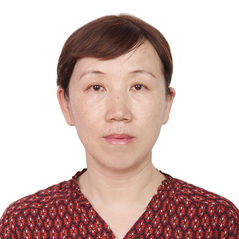
个人资料
个人简介杨丽萍,女,博士,副教授。主要从事环境遥感与3S综合应用方面的教学与科研工作。近年来,主持国家自然科学基金面上项目干旱区湖泊古环境多源重建与耦合研究,长安大学中央高校基本科研业务费专项资金项目基于光学和全极化雷达遥感的居延泽古水文研究、基于NDVI的干旱区典型绿洲植被覆盖动态变化过程与机制研究—以额济纳绿洲为例,参与国家自然科学基金面上项目及科技部973重点国际合作项目等多项科研项目。发表科研论文40余篇,其中SCI、EI检索论文10余篇。 社会职务研究领域 1. 环境遥感 2. 3S 综合应用 开授课程《空间分析》、《科技论文写作》、《专业英语》、《自然资源与环境遥感监测专题》、《遥感图像处理》 科研项目
论文1. Yang, L.P., Feng, X. D., Liu, F., Liu, J. and Sun, X. H., 2018. Potential of soil moisture estimation using C-band polarimetric SAR data in arid regions [J]. International Journal of Remote Sensing, 40(5-6): 2138-2150. 2. Yang, L. P., Li, Y. F., Li, Q.,Sun, X. H., Kong, J. L. and Wang, L., 2017. Implementation of a multi-angle soil moisture retrieval model using RADARSAT-2 imagery over arid Juyanze, northwest China [J]. Journal of Applied Remote Sensing, 11(3):1-13. 3. Yang, L. P., Sun, X. H., Feng, X. D. and Liu. F., 2017. A case study of scattering characteristics detection using PolSAR data in northwest arid China[A]. In Proceedings of the IEEE International Geoscience and Remote Sensing Symposium. Jul. 23-28, Texas, USA. 4. Yang, L. P., Meng, X. M. and Zhang, X. Q., 2011. SRTM and its application advances [J]. International Journal of Remote Sensing, 32(14): 3875–3896. 5. Yang, L. P., Chen, F. H., Chun, X., Fan, Y. X., Sun, Y., Madsen, D. B. and Zhang, X. Q., 2008. The Jilantai Salt Lake shorelines in northwestern arid China revealed by remote sensing images[J]. Journal of Arid Environments, 72 (5): 861–866. 6. Feng, X. D., Yang, L.P., Liu, F., Liu J. and Sun, X. H., 2017. Assessment of fully polarimetric RADARSAT-2 SAR imagery for soil parameter estimation in arid regions [A]. In Proceedings of the 5th International Symposium on Recent Advances in Quantitative Remote Sensing: RAQRS'V, Sep. 18-22th, Valencia, Spain. 7. Zhang, X. Q.,Yang, L. P. and Yamaguchi. Y., 2010. Retrieval of aerosol optical depth over urban areas using TERRA/MODIS data [A]. International Archives of the Photogrammetry, Remote Sensing and Spatial Information Science, Volume XXXVIII, Part 8, Kyoto Japan, 374-379. 8. Zhang J, Yang G, Yang L, Li Z, Gao M, Yu C, Gong E, Long H, Hu H., 2022. Dynamic monitoring of environmental quality in the Loess Plateau from 2000 to 2020 using the Google Earth Engine platform and the remote sensing ecological index[J]. Remote Sensing.14(20):5094. 9. Kong, J. L., Yang, J., Zhen, P. P., Li, J. J. and Yang, L. P., 2018. A Coupling Model for Soil Moisture Retrieval in Sparse Vegetation Covered Areas based on Microwave and Optical Remote Sensing Data[J] , IEEE Transactions on Geoscience and Remote Sensing[J]. 56(12):7162-7173. 10. Chen, F. H., Fan, Y. X., Chun, X., Madsen, D. B., Oviatt, C. G., Zhao, H., Yang, L. P. and Sun, Y., 2008. Preliminary research on Megalake Jilantai-Hetao in the arid areas of China during the Late Quaternary [J]. Chinese Science Bulletin, 53 (11):1725–1739. 11. Xia, D. S., Yang, L. P., Ma, J. Y., Yu, Y., Wang, G. and Chen, F. H., 2007. Magnetic characteristics of dustfall in urban area of north China and its environmental significance[J]. Science in China (Series D), 50 (11): 1724-1732. 12. 杨丽萍,张静,贡恩军,刘曼,任杰,王宇. GEE联合多源数据的西安市土地利用时空格局及驱动力分析[J].农业工程学报,2022,38(02):279-288. 13. 杨丽萍,任杰,王宇,张静,王彤,李凯旋.基于多源遥感数据的居延泽地区土壤盐分估算模型[J].农业机械学报,2022,53(11):226-235. 14.杨丽萍,侯成磊,苏志强,白宇兴,王彤,冯瑞.基于机器学习和全极化雷达数据的干旱区土壤湿度反演[J].农业工程学报,2021,37(13):74-82. 15.杨丽萍,侯成磊,赵美玲,白宇兴,苏志强.基于Landsat-8影像的干旱区土壤水分含量反演研究[J].土壤通报,2021,52(01):47-54. 16.杨丽萍,苏志强,侯成磊,白宇兴,王彤,孔金玲.基于随机森林算法的干旱区全极化SAR土壤水分反演[J].吉林大学学报(地球科学版),2022,52(04):1255-1264. 17.杨丽萍,白宇兴,朱江山,苏志强,王彤,孔金玲.基于优选植被指数和TVDI的额济纳绿洲旱情监测[J].兰州大学学报(自然科学版),2021,57(6):727-734. 18.杨丽萍,王彤,苏志强,侯成磊,冯瑞.随机森林反演绿洲土壤水分的特征参数优化降维方法[J].西北大学学报(自然科学版),2022,52(02):181-191. 19.杨丽萍,潘雪萍,刘晶,谢巍,马孟.基于Landsat影像的额济纳绿洲地表温度及冷岛效应时空格局研究[J].干旱区资源与环境,2019,33(02):116-121. 20.杨丽萍,刘飞,李雁飞,刘晶,李国强,金明.基于AIEM模型的干旱区裸露地表后向散射特性模拟[J].兰州大学学报(自然科学版),2019,55(2):176-182. 21.杨丽萍,刘晶,潘雪萍,刘飞,冯晓东.基于Landsat-8影像的西安市地表温度遥感反演与影响因子研究[J].兰州大学学报(自然科学版)2019,55(03):311-318. 22.杨丽萍,马孟,谢巍,潘雪萍.干旱区Landsat 8全色与多光谱数据融合算法评价[J].国土资源遥感,2019,31(04):11-19. 23.杨丽萍,王乐,孙晓辉,刘晶.基于遥感的西安市热力景观格局演变[J].水土保持研究, 2017,24(01):250-255,264. 24.杨丽萍,孔金玲,郭玉芳,王斌.西安城区地表温度的遥感反演与时空演变分析[J].兰州大学学报(自然科学版),2015,51(03):388-396. 25.杨丽萍,陈发虎,颉耀文.国内多源遥感影像信息融合技术的新进展[J].遥感技术与应用,2007,22(01):116-122. 26.杨丽萍,夏敦胜,陈发虎. Landsat7 ETM+全色与多光谱数据融合算法的比较[J].兰州大学学报(自然科学版),2007,43(04):7-11. 27.冯瑞,杨丽萍,侯成磊,王彤,张静,肖舜.基于随机森林的陕西省西安市近地表气温估算[J].地球科学与环境学报,2022,44(01):102-113. 28.张静,杨丽萍,贡恩军,王宇,任杰,刘曼.基于Google Earth Engine和改进型遥感生态指数的西安市生态环境质量动态监测[J].生态学报,2022,(05):1-14. 科技成果荣誉奖励工作经历1999.7~2009.4 兰州大学,资源环境学院遥感与地理信息系统研究所,副教授; 2009.5~2017.8 长安大学,地球科学与资源学院地理信息与城乡规划系,副教授; 2017.8 至今 长安大学,地质工程与测绘学院测绘科学系,副教授; 2018.9~2019.9 美国德克萨斯大学圣安东尼奥分校遥感与地学信息系统实验室,访问学者。 |

