个人资料
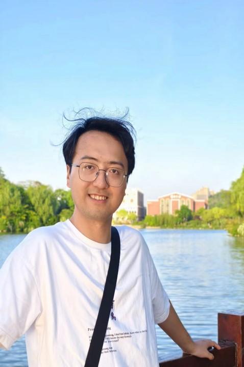
个人简介郭迪洲,男,汉族,籍贯江西信丰,1996年11月出生,中共党员,本硕博均就读于中国矿业大学,2023年4月至8月在香港理工大学担任研究助理,2024年6月获得大地测量学与测量工程博士学位。主持国家自然科学基金青年项目、中国博士后科学基金面上项目、陕西省自然科学基础研究计划等国家级/省部级科研项目4项,参与国家科技重大专项、省级共性技术研发平台等多项课题。研究方向为多源遥感影像时空融合与质量重建,以第一作者及通讯作者身份发表8篇SCI论文,包括《Remote Sensing of Environment》、《IEEE Transactions on Geoscience and Remote Sensing》等高水平期刊,授权发明专利4项。担任Remote Sensing of Environment,Geoscience and Remote Sensing Letters,Journal of Remote Sensing,International Journal of Digital Earth等期刊审稿人。曾获得2021年日内瓦国际发明展金奖,全球智慧城市峰会暨第三届国际城市信息学大会(GSCS & ICUI 2023)获最佳汇报奖,中国矿业大学优秀博士学位论文。 时空融合研究成果代码/程序主页链接:https://github.com/Andy-cumt 个人主页:https://www.researchgate.net/profile/Dizhou-Guo 欢迎对计算机视觉、深度学习、多源影像融合、遥感智能化处理方向感兴趣的同学报考本人研究生! 社会职务研究领域多源遥感影像时空数据融合与重建 基于深度学习的遥感智能处理 洪水灾害智能化检测 开授课程《计算机图形学》 科研项目[1]基于跨时空多模态融合的高分辨率无缝遥感影像重建方法研究,国自然青年科学基金项目,2026-2028,主持 [2]多云雾地区高时空分辨率无缝遥感影像重建方法研究,国家资助博士后研究人员计划,2025-2026,主持 [3]面向云污染场景的多模态遥感影像时空融合方法,中国博士后科学基金面上项目,2026-2027,主持 [4]面向秦岭地区全天候遥感精细监测的光学-SAR多模态影像时空融合方法研究,陕西省青年项目,2025-2026,主持 [5]基于多源遥感影像时空谱信息融合的薄云-厚云-云阴影协同去除方法研究,陕西省博士后项目,2025-2026,主持 [6]陕西秦岭北麓主体山水林田湖草沙一体化保护和修复工程子项目——生态环境监测与数字化工程建设,中国山水工程子项目,林草动态监测负责人 [7]基于深度学习的时空无缝高空间分辨率遥感影像重建方法研究,中央高校基本科研业务费,2025-2026,主持 论文[1] Guo, D., Li, Z*., Gao, X., Gao, M., Yu, C., Zhang, C., & Shi, W. (2025) RealFusion: A reliable deep learning-based spatiotemporal fusion framework for generating seamless fine-resolution imagery. Remote Sensing of Environment, 321, 114689.(中科院1区TOP) [2] Guo D., Li Z*., Jia Q., Hao, M. (2025) An improved ROBust OpTimization-based (iROBOT) fusion model for reliable spatiotemporal seamless remote sensing data reconstruction[J]. International Journal of Applied Earth Observation and Geoinformation, 2025, 145: 104964.(中科院1区TOP) 代码/数据:https://github.com/Andy-cumt/iROBOT_spatiotemporal-fusion [3] Guo, D., Shi, W*., Hao, M., & Zhu, X. (2020). FSDAF 2.0: Improving the performance of retrieving land cover changes and preserving spatial details. Remote Sensing of Environment, 248, 111973.(中科院1区TOP) 代码/数据:https://github.com/Andy-cumt/FSDAF2_GUI [4] Shi, W., Guo, D*., & Zhang, H. (2022). A reliable and adaptive spatiotemporal data fusion method for blending multi-spatiotemporal-resolution satellite images. Remote Sensing of Environment, 268, 112770.(中科院1区TOP) 代码/数据:https://github.com/Andy-cumt/RASDF_GUI [5] Guo, D., Shi, W*., Zhang, H., & Hao, M. (2022). A flexible object-level processing strategy to enhance the weight function-based spatiotemporal fusion method. IEEE Transactions on Geoscience and Remote Sensing, 60, 1-11.(中科院1区TOP) 代码/数据:https://github.com/Andy-cumt/Object-level-spatiotemporal-fusion-models [6] Guo, D., Shi, W*., Qian, F., Wang, S., & Cai, C. (2022). Monitoring the spatiotemporal change of Dongting Lake wetland by integrating Landsat and MODIS images, from 2001 to 2020. Ecological Informatics, 72, 101848.(中科院2区TOP) 代码/数据:https://github.com/Andy-cumt/Dongting-Lake-Data-2001-2020 [7] Guo, D., & Shi, W*. (2023). Object-Level Hybrid Spatiotemporal Fusion: Reaching a Better Trade-Off Among Spectral Accuracy, Spatial Accuracy and Efficiency. IEEE Journal of Selected Topics in Applied Earth Observations and Remote Sensing,16:8007-8021.(中科院2区TOP) 代码/数据:https://github.com/Andy-cumt/Object-level-spatiotemporal-fusion-models [8] Guo, D., & Shi, W*. (2023). A task decoupled framework for enhancing the deep learning-based spatiotemporal fusion method. International Journal of Remote Sensing, 44(13), 4163-4189.(中科院3区) 代码/数据:https://github.com/Andy-cumt/Spatiotemporal-fusion-dataset-DeepLearning 科技成果荣誉奖励工作经历 2024.6-至今 长安大学 讲师
|

