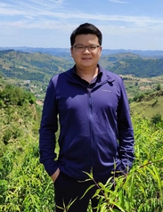
个人资料
个人简介赵建林,长安大学地质工程与测绘学院副教授,硕士研究生导师,“长安学者”青年骨干教师,比利时鲁汶大学地理学博士。主要研究方向:生态与地貌遥感监测,土地利用变化与模拟,土壤侵蚀与碳循环地表过程与建模。目前承担国家和省部级项目多项,发表期刊文章十余篇。担任《Geoderma》《Catena》《Geomorphology》《Land Degradation & Development》《Journal of Soil and Water Conservation》《Scientific report》等国际期刊审稿人。近年来指导本科生和研究生参加各类创新大赛,荣获“本科毕业设计优秀指导教师”、GIS大赛优秀指导教师,“测绘论文科技大赛”以及“互联网+”大赛指导教师等荣誉称号。 社会职务研究领域生态与地貌遥感监测 土地利用变化与模拟 土壤侵蚀与碳循环 地表过程与建模 开授课程空间分析(本科) 土地资源学(本科) 地籍测量与管理(本科) 基于R地学方法(硕士) Modelling land use change(硕士) 科研项目5. 陕西林业科技创新重点专项,黄土高原退耕林固碳增汇潜力评价及其动态监测,2023.05-2026.04,在研,主持 4. 国家自然科学基金项目,黄土高原淤地坝土壤有机碳埋藏效率及其环境控制因子研究,41907048,2020.01-2012.12,完成,主持 3. 中央高校基本科研业务费专项资金(高新技术研究培育项目),黄土高原土地利用变化与土壤侵蚀和有机碳动态耦合效应研究,300102260206,2020.01-2021.12,完成,主持 2. 陕西省自然科学基础研究计划项目(青年),基于Google Earth和地貌特征的黄土高原沟道密度研究,2019JQ-668,2019.01-2020.12,完成,主持 1. 中央高校基本科研业务费专项资金(优秀博士项目),淤地坝区侵蚀诱发土壤有机碳埋藏效率研究,300102268303,2018.01-2019.12,8万,完成,主持 论文Shi, L., Zhao, J *., Xiao S., Zhao C., Wang., Y. 2025. The carbon sequestration efficiency of conservation agriculture is constrained by initial carbon contents and duration: Evidence from a meta-analysis of experimental data in China. Catena Welu Hailemariam G., Zhao, J *., Moges A. 2024. Identification of Spatial Patterns of Soil Erosion Based on the Combination of RUSLE and MCDA in the Ahferom District, Northern Ethiopia. Land. Li, Y., Zhao, J *., Yuan, K., Taye, G., Li, L., 2024. Large-scale extraction of check dams and silted fields on the Chinese loess plateau using ensemble learning models. International Soil and Water Conservation Research. 6. Zhengang Wang, Yizhe Zhang, Aimin Chen, Nufang Fang, Jianlin Zhao & Guoping Tang. 2024. The sources and selectivity characteristics of organic carbon transported by debris flow events in a mountainous catchment, Southwest China. Journal of Soils and Sediments. Zhao, J *., Wang, Z., Dong, Y., Yang, Z., Govers, G., 2022. How soil erosion and runoff are related to land use, topography and annual precipitation: Insights from a meta-analysis of erosion plots in China. Sci. Total Environ. 802, 149665. Li, Y., Wang, Z., Zhao, J., Lin, Y., Tang, G., Tao, Z., Gao, Q., Chen, A., 2021. Characterizing soil losses in China using data of 137Cs inventories and erosion plots. Catena 203. Yuan, L., Li, L., Zhang, T., Chen, L., Zhao, J., Hu, S., Cheng, L., Liu, W., 2020. Soil moisture estimation for the Chinese loess plateau using MODIS-derived ATI and TVDI. Remote Sens. 12. Evans, D.L., Quinton, J.N., Davies, J.A.C., Zhao, J., Govers, G., 2020. Soil lifespans and how they can be extended by land use and management change. Environ. Res. Lett. 15. Yuan, L., Li, L., Zhang, T., Chen, L., Zhao, J., Hu, S., Cheng, L., Liu, W., 2020. Soil moisture estimation for the Chinese loess plateau using MODIS-derived ATI and TVDI. Remote Sens. 12. Zhao, J *., Yang, Z., Govers, G., 2019. Soil and water conservation measures reduce soil and water losses in China but not down to background levels: Evidence from erosion plot data. Geoderma 337, 729–741. Tian, Z., Yang, Z., Bendick, R., Zhao, J., Wang, S., Wu, X., Shi, Y., 2019. Present-day distribution of deformation around the southern Tibetan Plateau revealed by geodetic and seismic observations. J. Asian Earth Sci. Zhao, J *., Van Oost, K., Chen, L., Govers, G., 2016a. Moderate topsoil erosion rates constrain the magnitude of the erosion-induced carbon sink and agricultural productivity losses on the Chinese Loess Plateau. Biogeosciences 13, 4735–4750. Zhao, J*., Vanmaercke, M., Chen, L., Govers, G., 2016b. Vegetation cover and topography rather than human disturbance control gully density and sediment production on the Chinese Loess Plateau. Geomorphology 274, 92–105. 张 晨,常潇笛,赵建林*,汪珍亮,杨 节. 基于无人机影像和三维曲面模拟的淤地坝泥沙量估算. 水土保持研究,2025. 汪珍亮,陈曼玉,赵建林*,袁可,杨节,张晨. 基于InSAR的黄土高原延河流域滑坡降雨阈值模型构建.水土保持学报. 2024 袁可,张晨,赵建林*,汪珍亮,杨节,许中胜. 限样本下土壤有机碳密度空间分布预测模型对比分析. 水土保持研究. 2024 范天程,汪珍亮,李云飞,贾云飞,袁可,赵建林*. 基于机器学习的沟谷地貌识别模型对比—以黄土高原典型流域为例. 水土保持学报. 2023 范天程,贾云飞,李云飞,赵建林*. 基于遥感影像与逻辑回归模型的延河流域沟壑分布概率预. 水土保持研究. 2022 贾云飞,李云飞,范天程,曾竞,赵建林*.基于长时间序列的黄土高原延河流域及其沟壑区植被覆盖变化分. 水土保持研究. 2022 会议论文和报告: Zhao J, Large-scale extraction of check dams and silted fields on the Chinese Loess Plateau using ensemble learning methods, EGU General Assembly, Vienna, 2023.04. Oral presentation. Zhao J, Nonlinear response of soil erosion to mean annual precipitation evidence from erosion plot data in China, EGU General Assembly, Vienna, 2022.05. Oral presentation. Zhao J, Coupling of land use change, soil erosion and carbon dynamic on the Chinese Loess Plateau, EGU General Assembly, Vienna, 2020.05. Oral presentation 赵建林,土壤侵蚀对土地利用、地貌因子和年降雨变化的相应:基于径流小区的综合分析,第七届青年地学论坛,贵阳,2021-07。 赵建林,基于径流小区的水土保持措施效益综合评价 -水土保持措施能否有效降低中国水土流失?中国土壤学会土壤侵蚀与水土保持专业委员会2019年学术年会,大连,2019.08。 Zhao, J., Govers, G. (2016). Variations in vegetation cover and topography control gully density and sediment production on the Chinese Loess Plateau. EGU General Assembly. Vienna, 18 - 22 April 2016. Oral presentation. Zhao, J., Govers, G. (2015). Gully density and sediment contribution on Chinese Loess Plateau. Belgium Geography Day. Brussel, 13 November 2015. Oral presentation. Zhao, J., Govers, G. (2014). Reassessment of soil erosion on Chinese Loess Plateau: Were soil erosion rates overestimated? EGU General Assembly. Vienna, 27 April - 02 May 2014. Oral presentation. 科技成果荣誉奖励获奖和荣誉: 1. 2018年获长安大学本科毕业设计优秀指导教师 2. 2019年获中国煤炭工业科学技术奖二等奖 3. 2020年获第九届全国大学生GIS应用技能大赛优秀指导教师 4. 2022年获第十一届全国大学生GIS应用技能大赛优秀指导教师 5. 2023年获第十二届全国高校青年教师GIS教学研究班微课展示比赛二等奖
指导学生获奖: 1. 2018年指导学生荣获长安大学优秀本科毕业设计 2. 2018年指导学生荣获第十届全国高等学校学生测绘科技论文竞赛二等奖 3. 2020年指导学生荣获第九届全国大学生GIS应用技能大赛二等奖 4. 2021年指导学生荣获第十届全国大学生GIS应用技能大赛优胜奖 5. 2021年指导学生荣获第七届中国国际“互联网+”大学生创新创业大赛陕西赛区铜奖。 6. 2022年指导学生荣获第十一届全国大学生GIS应用技能大赛一等奖 7. 2022年指导学生荣获第七届中国国际“互联网+”大学生创新创业大赛陕西赛区银奖。 8. 2022年指导学生荣获第一届中国研究生“双碳”创新与创意大赛三等奖 9. 2023年指导学生荣获2023年全国大学测绘学科创新创业技能大赛-科技论文竞赛二等奖 10. 2023年指导学生荣获第十二届全国大学生GIS应用技能大赛二等奖 工作经历 |

